Markhor
From awareness
to action.
Markhor is a command and control platform for unmanned aircraft. We’re building it to be the hub between the aircraft and the team: fly the aircraft, see what it sees, work out where that is, and put it on the map the team already works from.
Markhor is in active development and is not yet available outside Lechuza.
The hub between the aircraft and the team
- AircraftArduPilot over USB, serial radio, UDP or TCP
- DetectionYour own model or software0.5Planned for 0.5.
- Data feedsADS-B traffic and other sourcesPlannedPlanned.
- TAKTeam positions and areas, back in1.1Planned for 1.1.
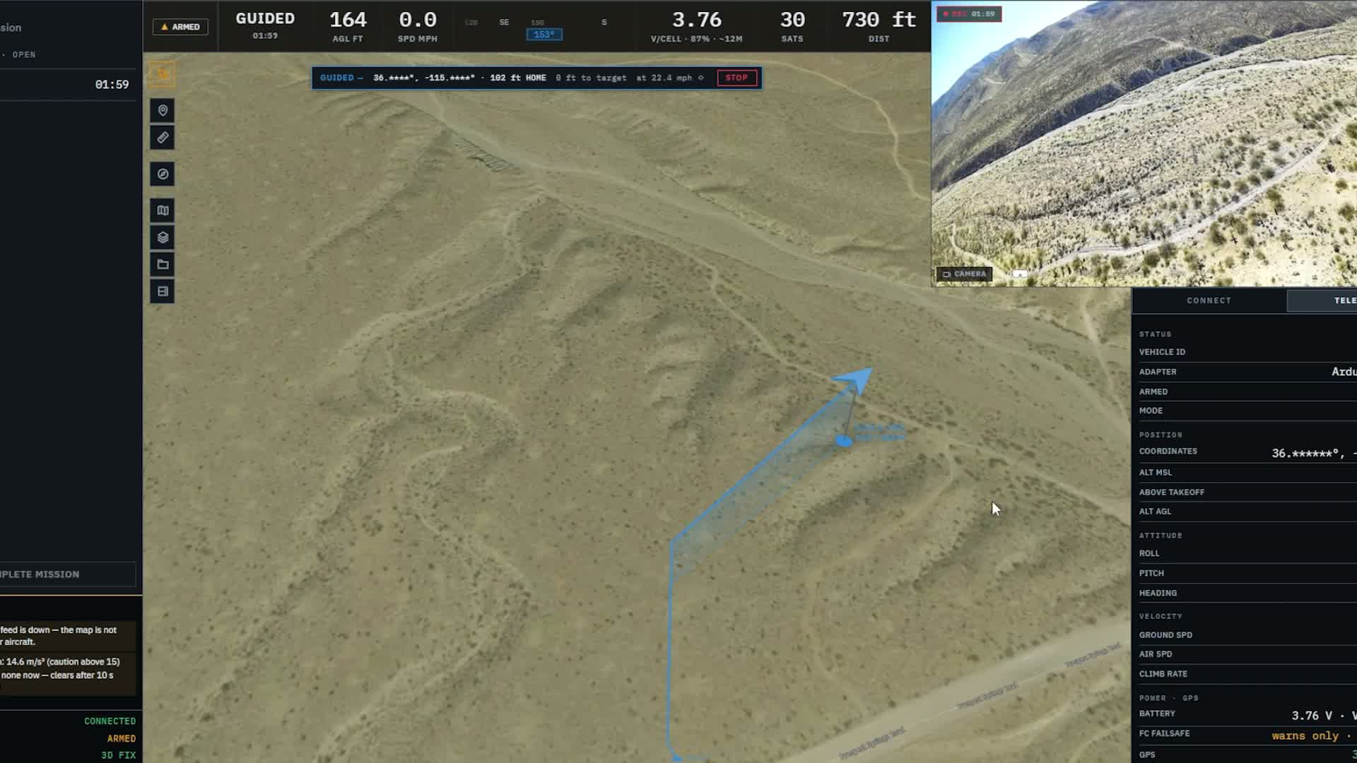
Existing development workspace · October 2026 capture.
At a glance
- Runs on
- Windows
- Aircraft
- ArduPilot (ArduCopter)
- Links
- USB, serial radio, UDP and TCP
- Video
- USB or HDMI capture
- Maps
- Offline packs, or your own MBTiles, GeoPackage and PMTiles
- Mid-flight
- Picks the flight back up after a restart or a graphics reset
- Team sharing
- TAK Planned · 0.6
Command
Fly the aircraft with the ground in view.
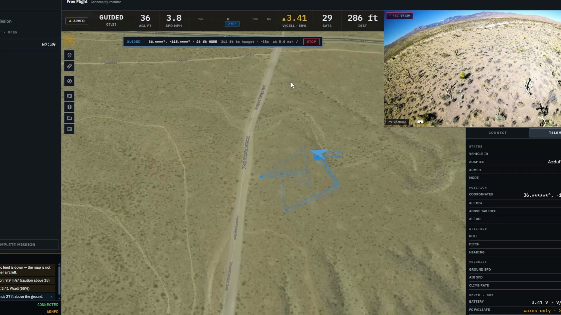
The controls and the aircraft’s state share one view with the terrain it is crossing, so the operator can act on what they see.
In the build
- Arm, take off and return to launch, with flight modes from the aircraft
- Attitude, speed, battery, GPS and link quality beside the map
- Adaptive or low-rate telemetry for limited links
- 3D terrain, with height above the ground and above takeoff
- Altitude alerts that step from a caution to a warning
Planned
Built for ArduCopter aircraft. The altitude readouts support the pilot’s judgement; they do not provide terrain following or collision avoidance.
Observe
See what the camera sees, and where.
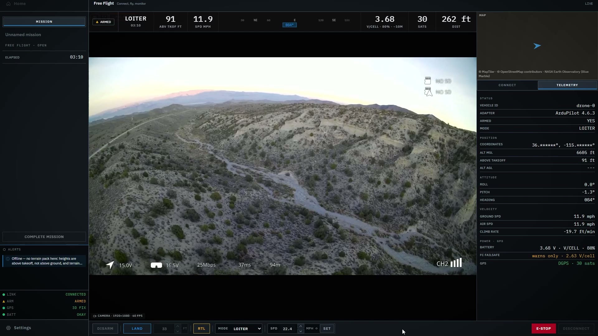
Live video sits beside the map, and an outline on the ground shows what the camera is covering.
In the build
- Live video from a USB or HDMI capture card
- A camera outline on the map, from the gimbal’s angle and the lens
- A sight-in at each power-up that corrects where the camera points
- Recordings that keep each frame’s time and where the camera pointed
- Recording continues in a new clip if the capture card drops out or changes size
Locate
Turn what you see into a location.
Click a spot in the video and Markhor places it on the terrain. A circle showing how far to trust it comes next.
In the build
- Click a spot in the live video to see where it is on the ground, with its coordinates and distance from the aircraft
Planned
The 95% figure is a target, not a result.
Who it’s for
One tool for the missions that put aircraft to work.
Markhor is built around the aircraft, what it sees and who needs to know, so the same workspace serves different operations.
Search and rescue
Cover the ground, find a person and send the team to them. This is the first mission we’re proving it on.
Public safety
Give the people running an incident a live view from the air and a location they can act on.
Defense
Direct aircraft gathering information and put what they find on the common operating picture.
Tell us about your operation.
If you run aircraft for an agency, a unit or a team, we’d like to hear how you work and what you need from your software.
A complete field exercise is planned for the 1.0 release.
Email updates
Follow what comes next.
Get product news, development milestones and updates from field testing at Lechuza.
Markhor is in active development and is not yet available outside Lechuza.
Explore the roadmapUnsubscribe any time. Privacy Policy.